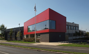
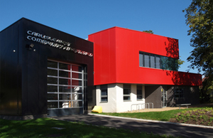
Carlisle East and West Community Fire Station
Tel: 0300 303 8623 Monday to Friday 9 a.m to 5 p.m
Both Carlisle stations are crewed by regular firefighters, Carlisle East houses one fire engine and one Aerial Ladder Platform (ALP), there are two of these in the county, the other is stationed at Barrow. Carlisle West houses one Enhanced Rescue Pump (ERP).
Both stations' firefighters are actively involved in a range of community safety activities including home safety visits and road awareness training.
Cumbria Fire and Rescue Service carry out Safe and Well Visits; please use the link below for more information.
Safe and Well Visits and Safety in your home

Next nearest supporting Fire Engine
Carlisle West - 4 miles
Brampton - 9 miles
Longtown - 11 miles
| Station Area | 37,300 population |
| Crewing Type | Regular |
| Fire Engines | 1 fire engine, 1 Aerial Ladder Platform and 1 Boat |
The city of Carlisle is situated in the north of the county near to the Scottish border, it has a population of around 102,000. Carlisle is steeped in history and has many historical monuments including Carlisle Castle, the Cathedral and the Citadel which was built by Henry VIII.
Although Carlisle dates back 2,000 years, it is a modern, thriving city offering shopping, entertainment, sports and sightseeing. It is the home of Carlisle United Football Club, an award winning museum and art gallery and the World Heritage site of Hadrian's Wall.
It is an important junction point for some of the counties main transport routes such as the West Coast Rail Line, the M6 Motorway, the A69 and the A695 which join together the North East of England and West Cumbria with Scotland and the North West of England. There is an Airport to the east of the city. The rivers Eden, Caldew and Petteril also converge in Carlisle before entering the Solway.
The area contains:
Four heritage sites; Carlisle Castle, Wetheral Priory, Carlisle Cathedral and Dalston Road Cemetery
The site contains 43 Grade I listed buildings and over 50 Grade II listed buildings
Rockcliffe Marsh is a Special Protected Area and there are 9 Sites of Specific Scientific Interest
There are 19 Site Specific Risks: Stead Mcalpine, Cumberland Infirmary, Atlas Works, Carnaud Metalbox, Bevcan, Pirelli Ltd, Carlisle United AFC, BSW Timber, BP Dalston, Nestles. AW Jenkinson Wodwaste, calor gas, Carlisle Airport, Carlisle Cathedral, Cumbria Waste Management Hespin Wood, FloGas UK, Ineos Dalston, Shanks Waste Management Hespin Wood
There are several Flood Warning Areas within Carlisle Station's catchment area. Warwick Bridge Flood risk area covers approximately 0.56 Km2 and consists of properties, roads and high quality agricultural land. There are in the region of 125 properties at risk of flooding. Low Crosby Flood risk area extends to approximately 4.309 Km2 and consists of approximately 130 properties. Significant parts of the City of Carlisle that lie within the flood plains of the Rivers Eden and Petteril are vulnerable to flooding. The Flood Warning area covers approximately 9.40 Km2 and vulnerable areas of the city consist of domestic, commercial and industrial properties. The majority of properties at risk are residential adjacent to the Warwick Road area but also include commercial and industrial properties in Willowholme, Caldewgate and Rickergate areas. In total there are over 2000 properties within the risk area and in January 2005 the City was subject to unprecedented flooding. The Harraby Green flood risk area covers 0.064 Km2 adjacent to the River Petteril and includes almost 50 commercial and residential properties. The natural floodplain of the River Caldew virtually disappears on entering the City of Carlisle and flows through the suburbs of Denton Hollme, Caldewgate and Willowholme joining the River Eden to the northwest of the city at the Sauceries. The Flood Warning Area covers less that a square kilometre but it is an intensively developed urban area comprising of mainly terraced residential housing, commercial and industrial properties, with almost 3000 properties at risk, including key vulnerable infrastructure such as an Electrical Sub Station, Waste Water Pumping Station, Transco and British Gas sites.
The table shows the number of incidents that have occurred within nominal area assigned to the station (as shown on the map in the station profile). This is different to the number of incidents attended by fire engines which are based at the station, as they may attend incidents outside their station area.
| Fire | 2017/18 | 2018/19 | 2019/20 | |
| All emergencies attended | 356 | 357 | 368 | |
| All Fires | 120 | 156 | 170 | |
| Accidental primary dwelling fires | 21 | 30 | 32 | |
| Secondary fires | 13 | 75 | 92 | |
| Chimney fires | 7 | 6 | 5 | |
| Deliberate primary fires | 15 | 20 | 15 | |
| Deliberate secondary fires | 46 | 50 | 71 | |
| False Alarms | ||||
| All false alarms | 177 | 136 | 122 | |
| Special Service Calls | ||||
| Non Road Traffic Collisions Special Service Calls | 42 | 26 | 61 | |
| Road Traffic Collisions Special Service Calls | 17 | 39 | 15 |
Response times
Regular Fire Engine
| Fire Engine C20P1 | 2017/18 | 2018/19 | 2019/20 |
| Average crew turnout time (time it takes the crew to respond to the station) | 1 min 42 secs | 1 min 23 secs | 1 min 17 secs |
| Average response time (time it takes the crew to arrive at the incident from the station) | 7 min 22secs | 8 min 11 secs | 7 mins 34 secs |
| Number of incidents attended by fire engine C20P1 | 502 | 512 | 493 |
Availability
Regular Fire Engine
| Fire Engine C20P1 | 2016/17 | 2017/18 | 2018/19 |
| Total Availability | 100% | 100% | 100% |
| Mon - Fri (08:00 - 18:00) | 100% | 100% | 100% |
| Mon - Thurs (18:00 - 08:00) | 100% | 100% | 100% |
| Fri - Mon (18:00 - 08:00) | 100% | 100% | 100% |
Further information for this fire station is available on a number of themes at the Cumbria Intelligence Observatory, including:
Population
Crime and Community
Health and Social Care
Housing
Economy and Employment
Environment
Children and Young People
Please visit www.cumbriaobservatory.org.uk and choose a fire station area for your particular theme of interest.

Next nearest supporting Fire Engine
Carlisle East - 4 miles
Longtown - 10 miles
Brampton - 11 miles
| Station Area | 56,300 population |
| Crewing Type | Regular |
| Fire Engines | 1 Enhanced Rescue Pump |
The city of Carlisle is situated in the north of the county near to the Scottish border, it has a population of around 102,000. Carlisle is steeped in history and has many historical monuments including Carlisle Castle, the Cathedral and the Citadel which was built by Henry VIII.
Although Carlisle dates back 2,000 years, it is a modern, thriving city offering shopping, entertainment, sports and sightseeing. It is the home of Carlisle United Football Club, an award winning museum and art gallery and the World Heritage site of Hadrian's Wall.
It is an important junction point for some of the counties main transport routes such as the West Coast Rail Line, the M6 Motorway, the A69 and the A595 which join together the North East of England and West Cumbria with Scotland and the North West of England. There is an Airport to the east of the city. The rivers Eden, Caldew and Petteril also converge in Carlisle before entering the Solway.
The area contains:
Four heritage sites; Carlisle Castle, Wetheral Priory, Carlisle Cathedral and Dalston Road Cemetery
The site contains 43 Grade I listed buildings and over 50 Grade II listed buildings
Rockcliffe Marsh is a Special Protected Area and there are 9 Sites of Specific Scientific Interest
There are 19 Site Specific Risks: Stead Mcalpine, Cumberland Infirmary, Atlas Works, Carnaud Metalbox, Bevcan, Pirelli Ltd, Carlisle United AFC, BSW Timber, BP Dalston, Nestles. AW Jenkinson Woodwaste, Calor Gas, Carlisle Airport, Carlisle Cathedral, Cumbria Waste Management Hespin Wood, FloGas UK, Ineos Dalston, Shanks Waste Management Hespin Wood
There are several Flood Warning Areas within Carlisle Station's catchment area. Warwick Bridge Flood risk area covers approximately 0.56 Km2 and consists of properties, roads and high quality agricultural land. There are in the region of 125 properties at risk of flooding. Low Crosby Flood risk area extends to approximately 4.309 Km2 and consists of approximately 130 properties. Significant parts of the City of Carlisle that lie within the flood plains of the Rivers Eden and Petteril are vulnerable to flooding. The Flood Warning area covers approximately 9.40 Km2 and vulnerable areas of the city consist of domestic, commercial and industrial properties. The majority of properties at risk are residential adjacent to the Warwick Road area but also include commercial and industrial properties in Willowholme, Caldewgate and Rickergate areas. In total there are over 2000 properties within the risk area and in January 2005 the City was subject to unprecedented flooding. The Harraby Green flood risk area covers 0.064 Km2 adjacent to the River Petteril and includes almost 50 commercial and residential properties. The natural floodplain of the River Caldew virtually disappears on entering the City of Carlisle and flows through the suburbs of Denton Hollme, Caldewgate and Willowholme joining the River Eden to the northwest of the city at the Sauceries. The Flood Warning Area covers less that a square kilometre but it is an intensively developed urban area comprising of mainly terraced residential housing, commercial and industrial properties, with almost 3000 properties at risk, including key vulnerable infrastructure such as an Electrical Sub Station, Waste Water Pumping Station, Transco and British Gas sites.
The table shows the number of incidents that have occurred within nominal area assigned to the station (as shown on the map in the station profile). This is different to the number of incidents attended by fire engines which are based at the station, as they may attend incidents outside their station area.
| Fire | 2017/18 | 2018/19 | 2019/20 | |
| All emergencies attended | 348 | 358 | 384 | |
| All Fires | 117 | 148 | 165 | |
| Accidental primary dwelling fires | 19 | 25 | 26 | |
| Secondary fires | 4 | 83 | 103 | |
| Chimney fires | 4 | 3 | 8 | |
| Deliberate primary fires | 22 | 16 | 11 | |
| Deliberate secondary fires | 47 | 52 | 73 | |
| False Alarms | ||||
| All false alarms | 169 | 138 | 130 | |
| Special Service Calls | ||||
| Non Road Traffic Collisions Special Service Calls | 46 | 13 | 75 | |
| Road Traffic Collisions Special Service Calls | 16 | 57 | 14 |
Response times
Regular Fire Engine
| Fire Engine C21P1 | 2016/17 | 2017/18 | 2018/19 |
| Average crew turnout time (time it takes the crew to respond to the station) | 1 min 14 secs | 1 min 11 secs | 1 min 04 secs |
| Average response time (time it takes the crew to arrive at the incident from the station) | 6 mins 58 secs | 7 mins 44 secs | 7 mins 01 secs |
| Number of incidents attended by fire engine C21P1 | 488 | 531 | 523 |
Availability of fire engines
Regular Fire Engine
| Fire Engine C21P1 | 2016/17 | 2017/18 | 2018/19 |
| Total Availability | 100% | 100% | 100% |
| Mon - Fri (08:00 - 18:00) | 100% | 100% | 100% |
| Mon - Thurs (18:00 - 08:00) | 100% | 100% | 100% |
| Fri - Mon (18:00 - 08:00) | 100% | 100% | 100% |
Further information for this fire station is available on a number of themes at the Cumbria Intelligence Observatory, including:
Population
Crime and Community
Health and Social Care
Housing
Economy and Employment
Environment
Children and Young People
Please visit www.cumbriaobservatory.org.uk and choose a fire station area for your particular theme of interest.